Department of Environment, Land, Water and Planning
Planned Burns Map


prototype
Environment
Fellowship
Partner


Background
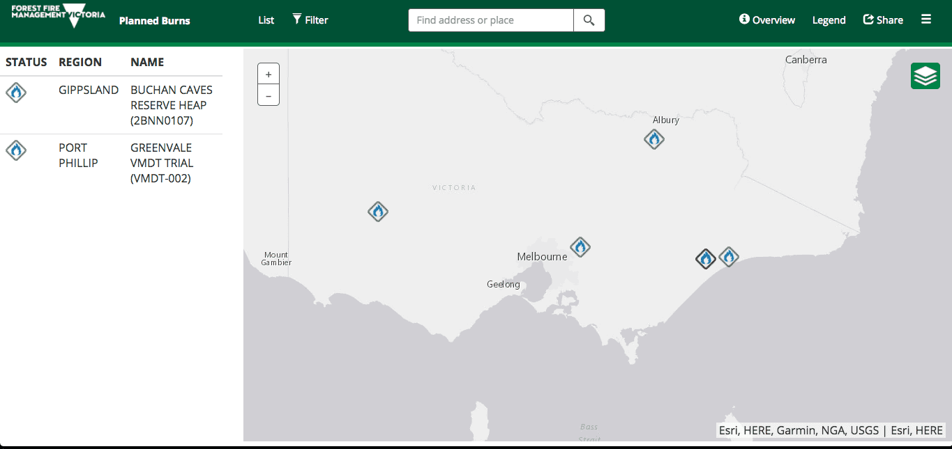
The Department currently has 3 separate maps; 24 hour outlook, 10 day planned burns and 1 year planned burn, as well as a notification system.


THE ASK
Users find it increasingly difficult to navigate between the 4 separate pages, as well as having no profile features to set multiple warnings for their area
This project sought to create a functional prototype that would assist the department to communicate stages of planned burns with a user-friendly and accessible mapping tool. The tool would provide allow the community to prepare for burns around their locations, as well as an include information about the reasons behind burns.
LEARN MORE
Check out the code here.
Back to Case Studies
Read more of our Case Studies to dig deeper into the work we've done.


